
We ensure clear communication by providing real-time updates, detailed aerial reports, and seamless collaboration with project managers, keeping all stakeholders informed throughout every stage of the construction process
Enhance Your Construction Projects with Our Central Florida Drone Solutions
Since 2014, Florida Construction Drone Services has been a trusted partner for contractors, developers, and project managers across Orlando, Tampa, Kissimmee, Lakeland, Gainesville, and the entire Central Florida region. While many drone companies serve a variety of industries, we exclusively specialize in construction, giving us the expertise and framework to deliver precise, consistent, and actionable data tailored to the needs of the construction industry.
We understand the challenges that project managers face—tracking progress across multiple sites, ensuring compliance, and maintaining efficiency, all while dealing with tight deadlines. Our construction-focused drone services eliminate the hassle of managing individual drone pilots by providing a scalable, reliable, and fully managed solution for aerial data collection. From high-resolution aerial imagery to detailed 3D mapping, site progress monitoring, and thermal inspections, we ensure that every project gets accurate, real-time insights without disrupting operations.
With our FAA-certified drone pilots and industry-leading technology, we help construction firms save time, reduce costs, and improve safety by providing automated, repeatable, and reliable drone data. Whether you're working on a large-scale commercial project in Orlando, a residential development in Tampa, or a roadway expansion in Kissimmee, our team is equipped to support your needs with professional-grade drone solutions.
At Florida Construction Drone Services, we are committed to delivering consistent results—so you can focus on managing your projects while we handle the aerial data collection. Experience the future of construction project management with our expert drone services. Contact us today to get started!
Drone Services We Offer
Some of the Drone Services we offer for the construction industry include:
Site Surveys and Mapping
Safety Inspections
Inventory and Material Management
Key Benefits of Our Construction Drone Services in Central Florida
")
Enhanced Project Monitoring & Documentation
Keep stakeholders, investors, and project managers informed with consistent aerial progress updates. Our drone photography, aerial video, and time-lapse imagery provide clear documentation at every stage of development, ensuring seamless communication and better decision-making. Best of all, you don’t have to leave your office—monitor multiple job sites daily and track progress remotely with high-resolution aerial data.
From commercial developments in Orlando to highway expansions along I-4, U.S. Highway 27, and State Road 408, our detailed drone documentation helps contractors, developers, and engineers maintain precision, efficiency, and compliance. With the added benefit of 3D modeling at each site visit, you gain an even deeper level of insight, making construction progress monitoring in Central Florida more accurate, efficient, and hassle-free than ever.
High-Quality Visuals for Stakeholder Presentations
Showcase your project’s progress with stunning aerial photography and videography, ideal for investor updates, permitting approvals, and marketing materials.
Whether you're a project manager with a large construction company, or a small real estate developer, our high-quality drone photography and aerial video are perfect to showcase construction progress to your clients or stakeholders
Our drone pilots are trained to bring a creative eye to each construction site, so that you rest easy knowing that we will get you all the visuals you need to show off the progress of your construction.
")

Cost Savings by Identifying Issues Early
Identify potential issues before they escalate with high-accuracy drone site surveys designed to keep your construction project on track. Our drones capture precise 3D mapping and thermal scans, helping contractors detect structural concerns, material inconsistencies, and site inefficiencies early—reducing costly rework and preventing delays.
We’ve helped Central Florida construction companies operate smarter and more efficiently, from large-scale commercial builds in Orlando and Tampa to infrastructure projects in Lakeland, Kissimmee, and Gainesville. With our detailed aerial insights, you can make informed decisions, optimize resources, and keep projects on schedule and within budget.
Improve Safety with Remote Inspections
Reduce risks on your Central Florida construction site with FAA-certified drone inspections, eliminating the need for workers to access hazardous scaffolding, rooftops, or excavation sites. Our drones provide a safer, faster, and more efficient way to assess job sites while ensuring compliance with OSHA and Florida safety regulations.
Whether inspecting high-rise developments in Orlando, monitoring utility projects in Tampa, or conducting infrastructure assessments in Kissimmee, Lakeland, and Gainesville, our drones deliver high-resolution imagery and real-time video for detailed site evaluations. Conduct surprise safety inspections to ensure crews are following proper protocols, remotely check for equipment malfunctions, and catch potential hazards before they become costly problems—all without ever stepping foot on-site.
")
Build Better with Consistent, High-Quality Media
Elevate Your Construction Sites Today!
Build Better with Consistent, High-Quality Media
Elevate Your Construction Sites Today!
Why Choose Us?
Experienced FAA Certified Pilots
Our drone pilots are FAA-certified and have years of experience capturing high-quality imagery for construction projects. We train using our unique construction framework that we've developed over years of providing drone services
Consistent Results
We deliver consistent results by using advanced drone technology, precise data collection methods, and standardized workflows, ensuring accuracy and reliability on every construction project
Clear Communication
Licensed & Insured
We prioritize safety and risk management by maintaining 2m+ insurance coverage when requested, ensuring that you can focus on your project's progress while knowing you're protected by professional and responsible drone services.
Construction Sites We Have Flown Recently
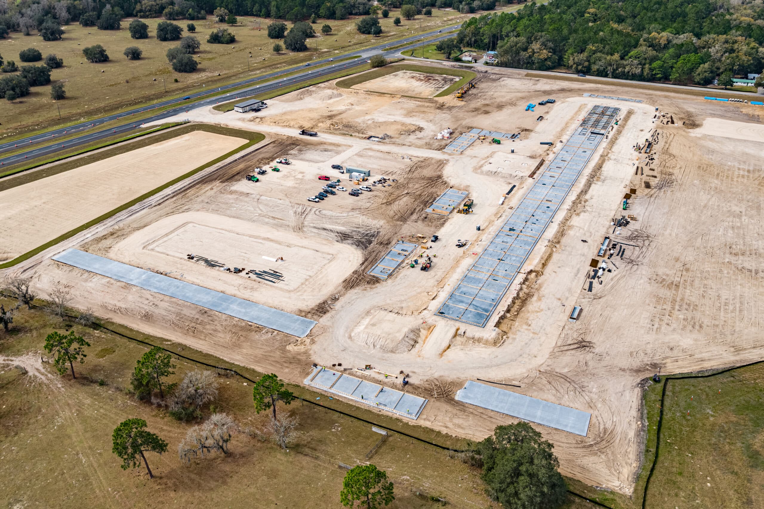
 Construction Progress Monitoring
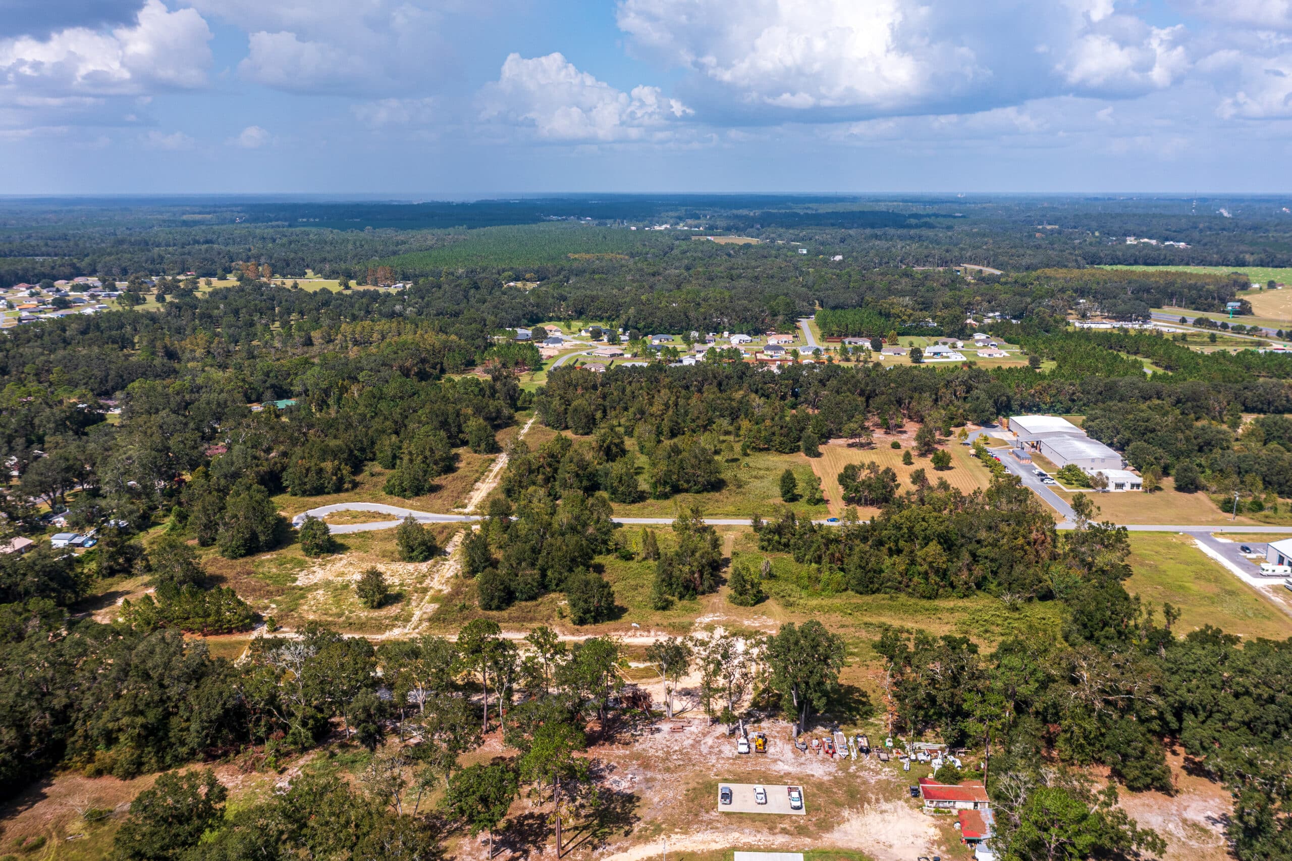
10th Progress Monitoring Visit – Wildwood, FL
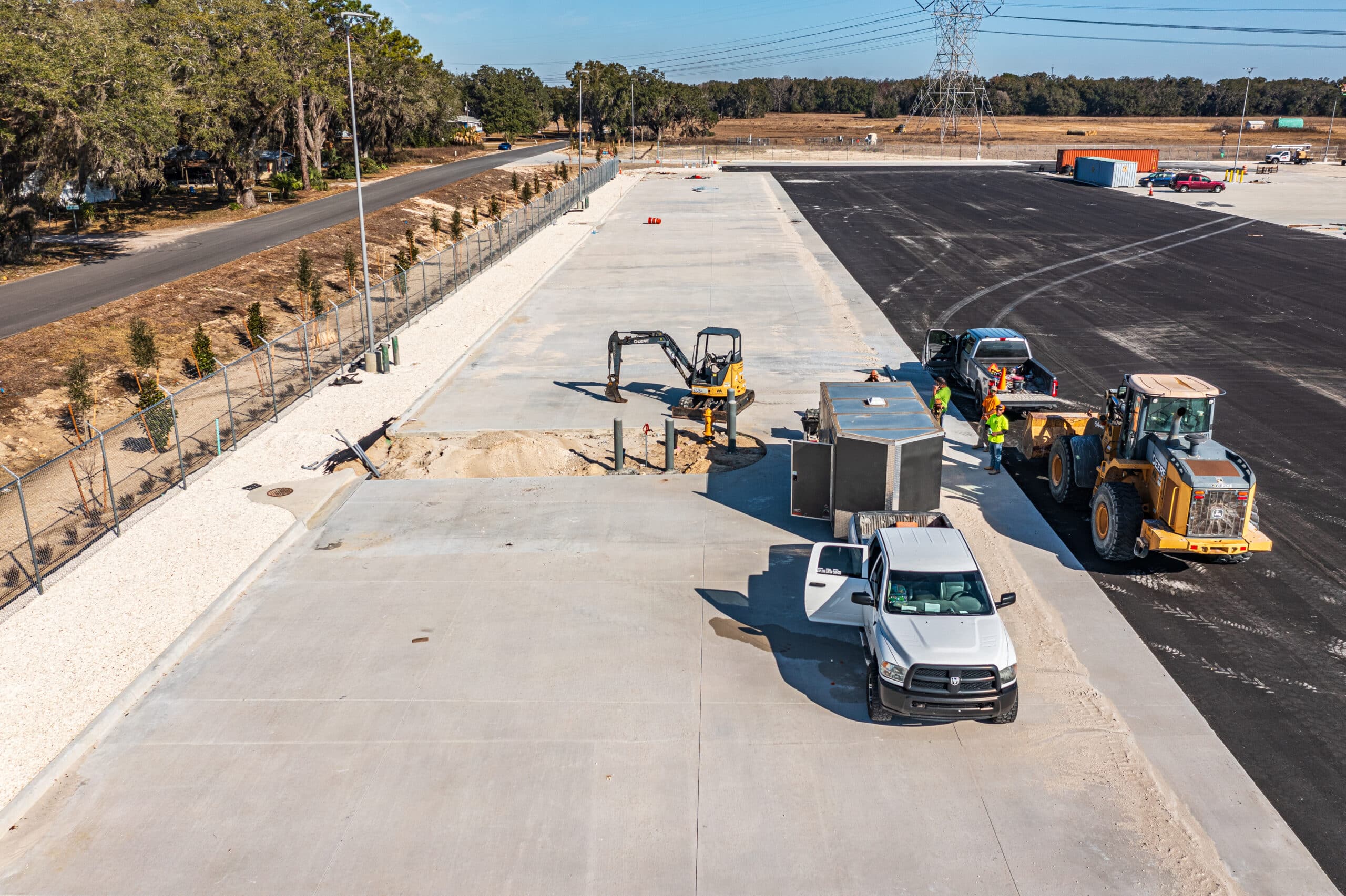
 Construction Progress Monitoring
Construction Progress Monitoring in Marion County, FL
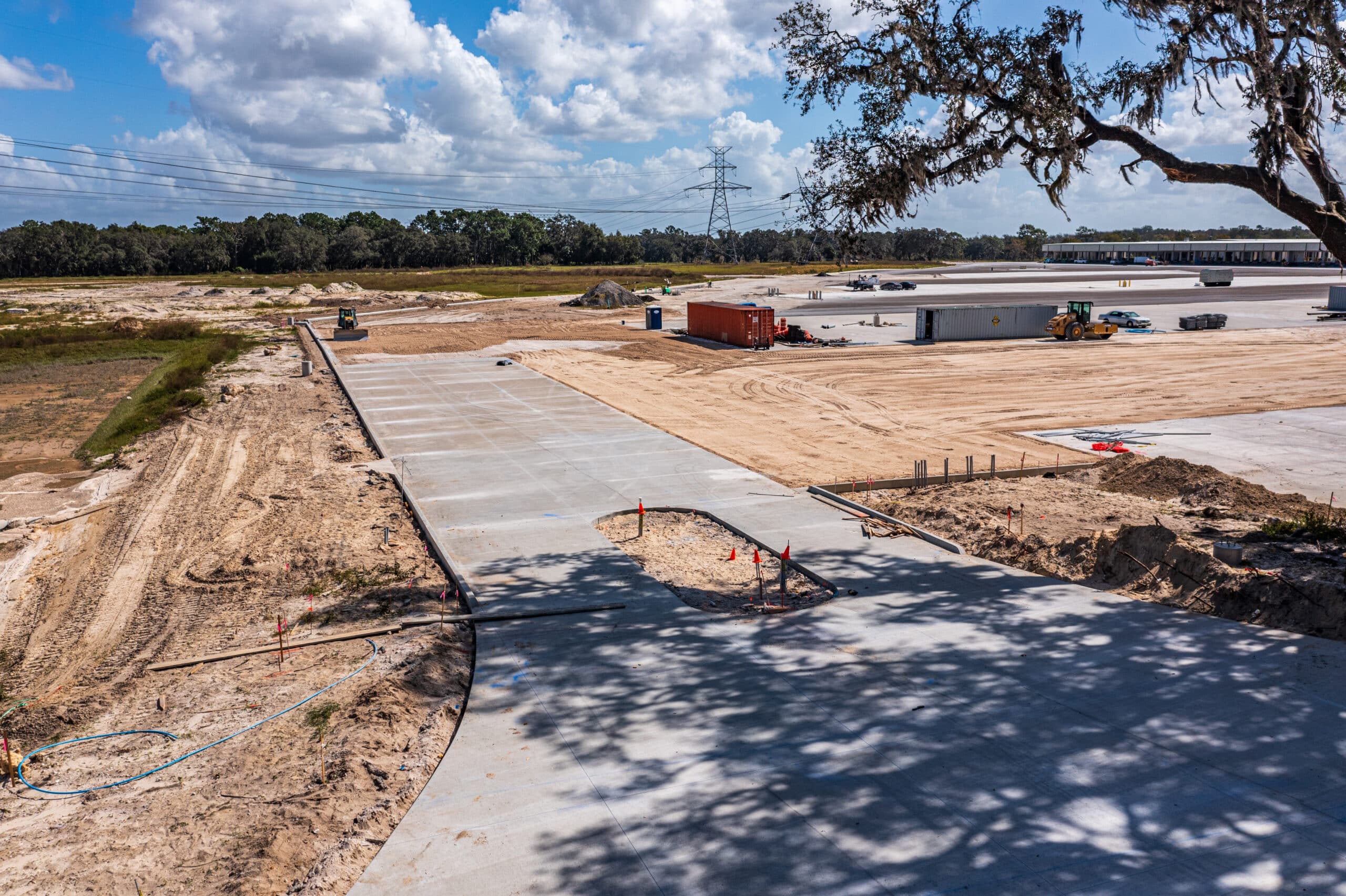
- Construction Progress Monitoring
Drone Construction Progress Monitoring in Wildwood, FL
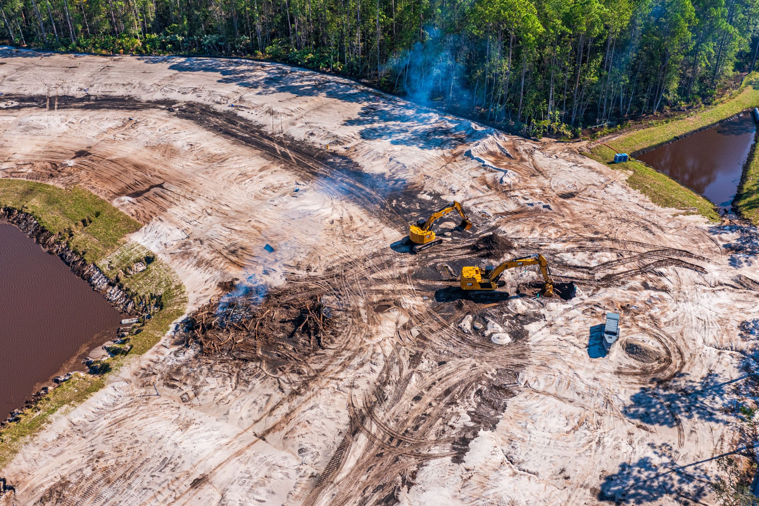
- Construction Progress Monitoring
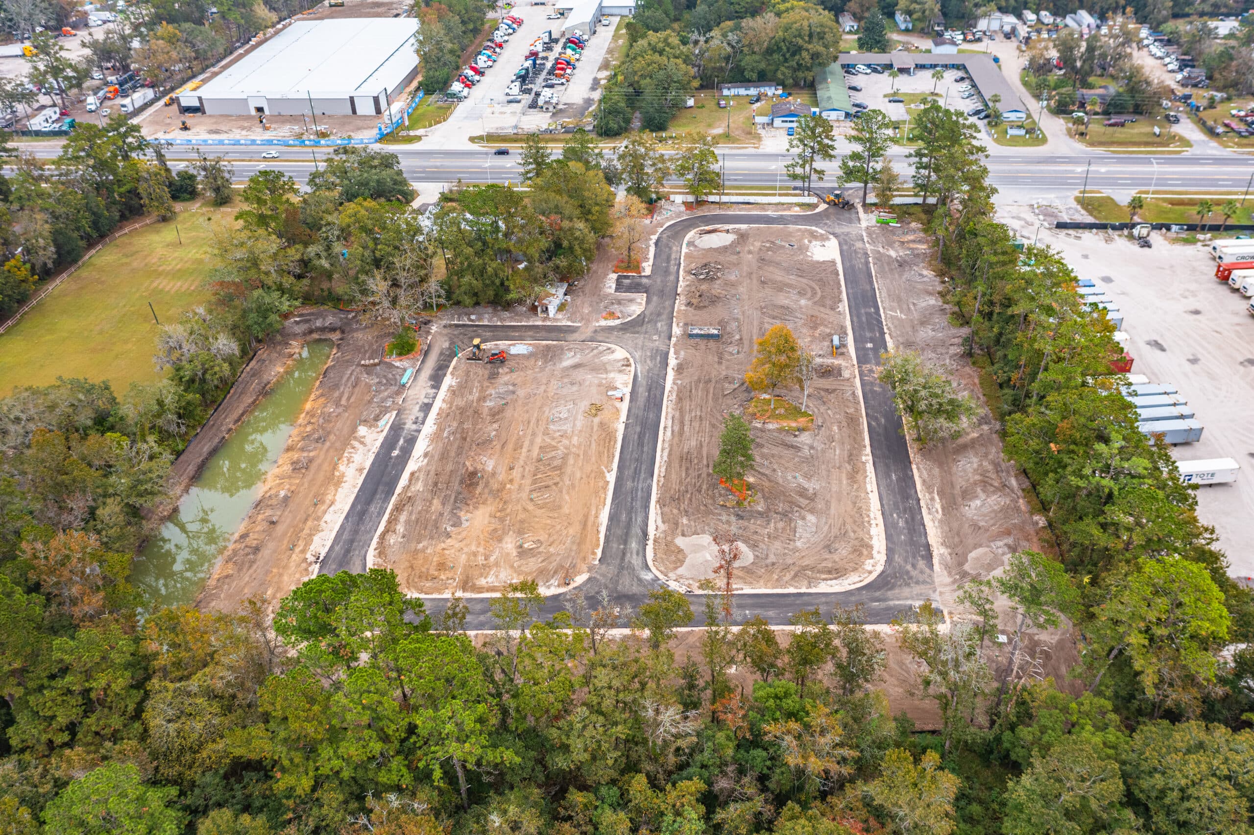
Construction Drone Photography in St Johns County FL
- Construction Progress Monitoring
Pictures of RV Park in Jacksonville FL
- Construction Progress Monitoring
1st Lake City Construction Drone Visit
Our Process for Construction Drone Services
At FL Construction Drone Services, we follow a structured, results-driven process to ensure our drone services meet the unique needs of project managers, contractors, developers, and architects.
From initial consultation to final data delivery, our goal is to provide precise, high-quality insights that help you build smarter, faster, and safer.
We have come to develop this process that allows us to provide drone solutions tailored for the construction industry
01
Step 1: Initial Consultation to Understand Project Needs
Every construction project is unique, which is why we start with a detailed consultation to assess your specific requirements. Whether you need progress tracking for a high-rise downtown, site surveys for a UF campus expansion, or safety inspections for an I-75 infrastructure project, we customize our approach to deliver the best results.
02
Step 2: Customized Flight Planning & Scheduling
Once we understand your needs, our FAA-certified drone pilots create a customized flight plan that optimizes coverage, efficiency, and safety. We schedule flights at times that minimize disruption to your operations, ensuring seamless integration with your existing workflow.
03
Step 3: Data Collection & Analysis
Using state-of-the-art drones equipped with high-resolution cameras, LiDAR, and thermal imaging, we capture detailed aerial imagery, 3D maps, and site data. Our team then processes and analyzes the data, identifying key insights such as site progress, potential hazards, or material shortages before they cause delays.
04
Step 4: Delivery of Actionable Insights & High-Resolution Imagery
We provide easy-to-interpret reports, high-resolution visuals, and actionable insights that help you make informed decisions quickly. Our deliverables include Aerial photos and videos for stakeholder presentations, 3D site maps for accurate planning and progress tracking, Thermal imaging reports for safety assessments, and Custom data exports compatible with your project management software.
Our Drone Pilots are available to fly Construction Sites in the following cities and areas:
Build Better with Consistent, High-Quality Media
Elevate Your Construction Sites Today!
Build Better with Consistent, High-Quality Media
Elevate Your Construction Sites Today!
© 2026 FL Construction Drone Services | All rights reserved