
We ensure clear communication by providing real-time updates, detailed aerial reports, and seamless collaboration with project managers, keeping all stakeholders informed throughout every stage of the construction process
The Power of Aerial Photography in Construction
In the fast-paced world of construction, having a clear, real-time view of a project’s progress is essential for efficiency, safety, and decision-making. Aerial photography, powered by advanced drone technology, has revolutionized the way construction sites are monitored, inspected, and documented. By capturing high-resolution aerial images and videos, drones provide unparalleled perspectives of construction sites, offering project managers, contractors, and stakeholders the ability to track progress, identify potential issues, and improve overall site management.
One of the biggest advantages of aerial photography in construction is its ability to enhance project oversight. Instead of relying solely on ground-level inspections, drones can cover large areas quickly, providing comprehensive site overviews that help teams make informed decisions. Whether it's tracking materials, monitoring equipment usage, or assessing site logistics, aerial imagery ensures that projects stay on schedule and within budget.
Drones also play a crucial role in construction safety and compliance. By capturing aerial views of the job site, teams can identify potential hazards, monitor worker safety protocols, and ensure adherence to OSHA regulations. This proactive approach reduces risks and minimizes the likelihood of costly accidents, making drone photography a valuable tool for safety managers and site supervisors.
Beyond project management, aerial photography is a powerful tool for stakeholder communication and marketing. High-quality aerial images and videos provide a visually compelling way to showcase progress to investors, clients, and the public. Developers and construction firms can use this content for progress reports, investor updates, and promotional materials, helping to build trust and credibility in the industry.
Whether it's for progress tracking, safety inspections, surveying, or marketing, aerial photography has become an indispensable asset in modern construction. By leveraging the power of drone technology, construction professionals can work smarter, reduce costs, and achieve greater accuracy in every phase of their projects.
Drone Services We Offer
Some of the Drone Services we offer for the construction industry include:
Site Surveys and Mapping
Safety Inspections
Inventory and Material Management
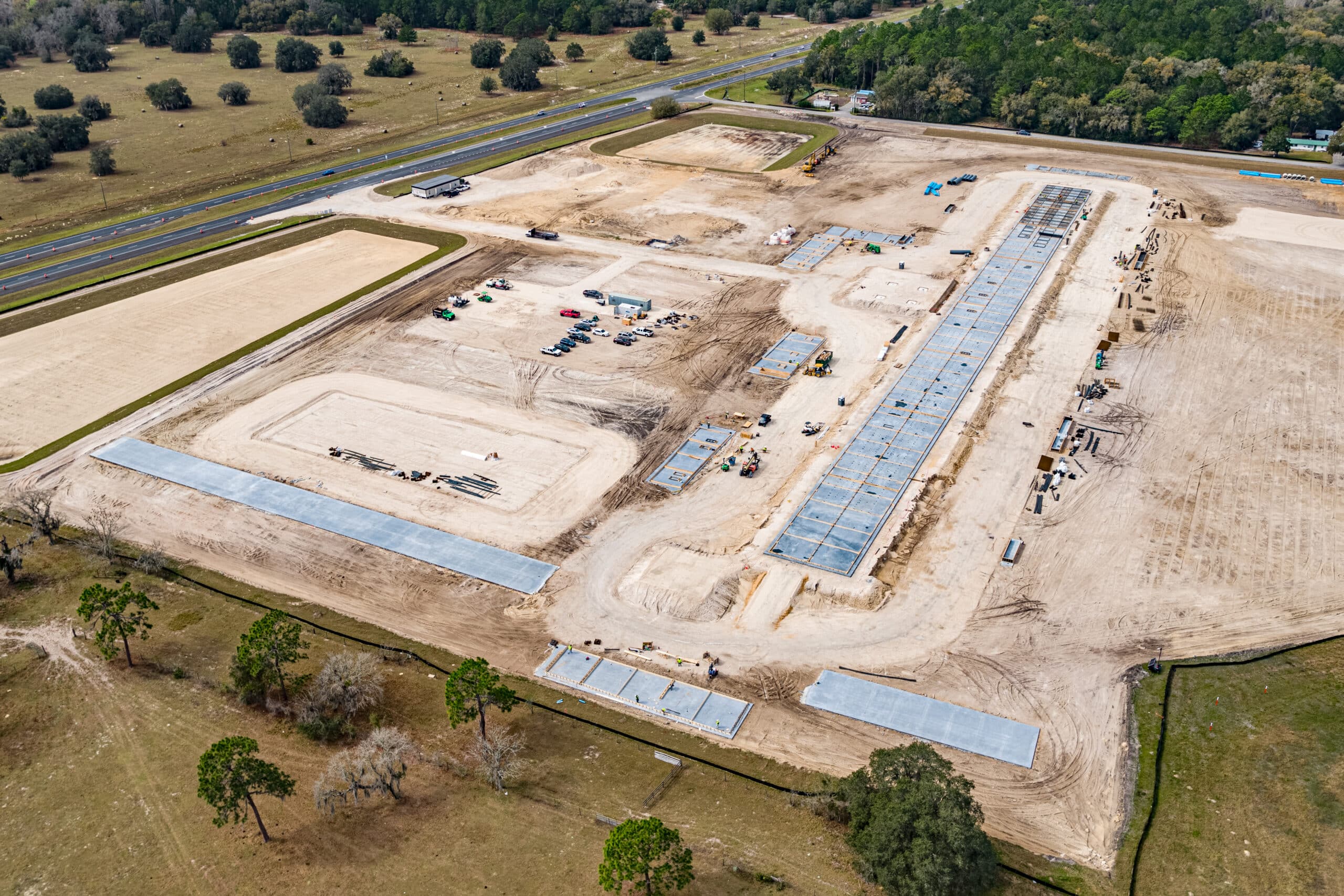
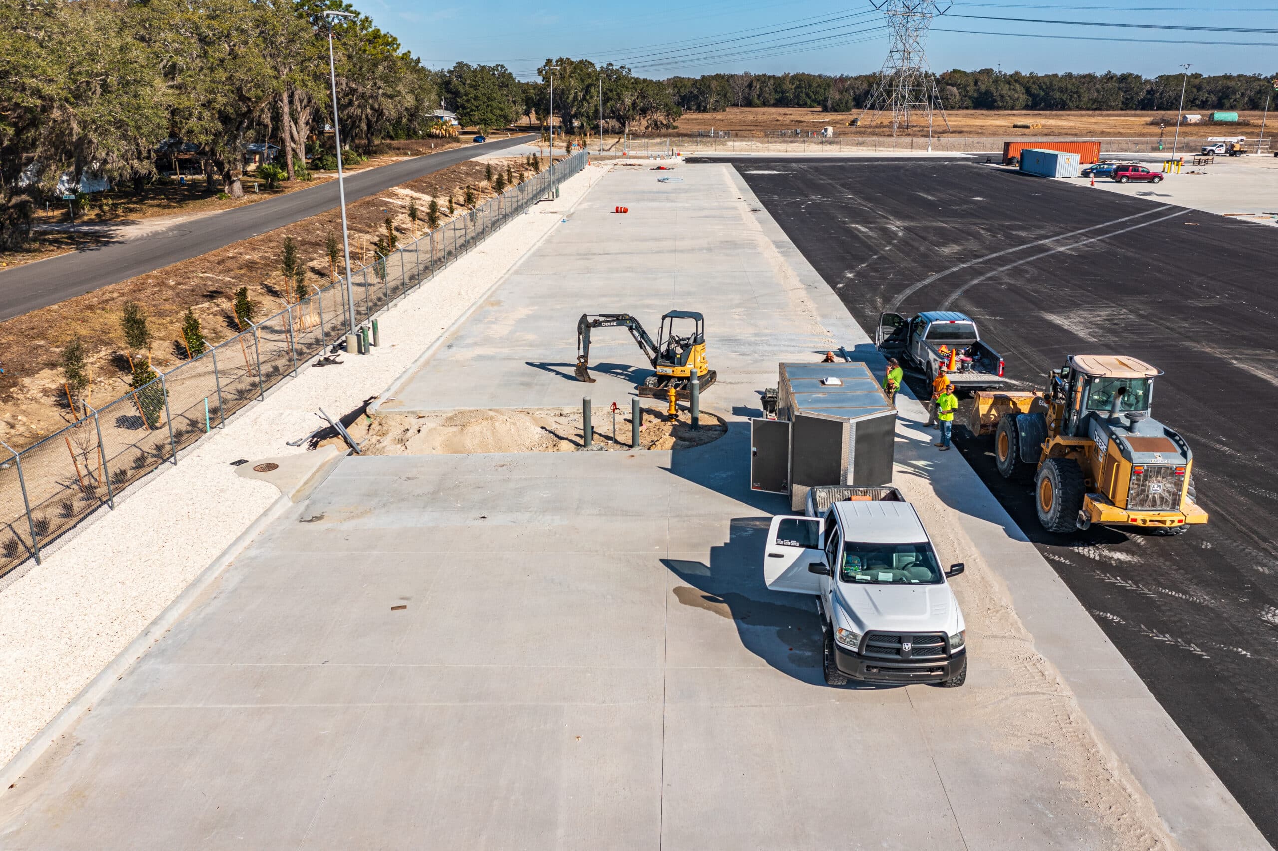
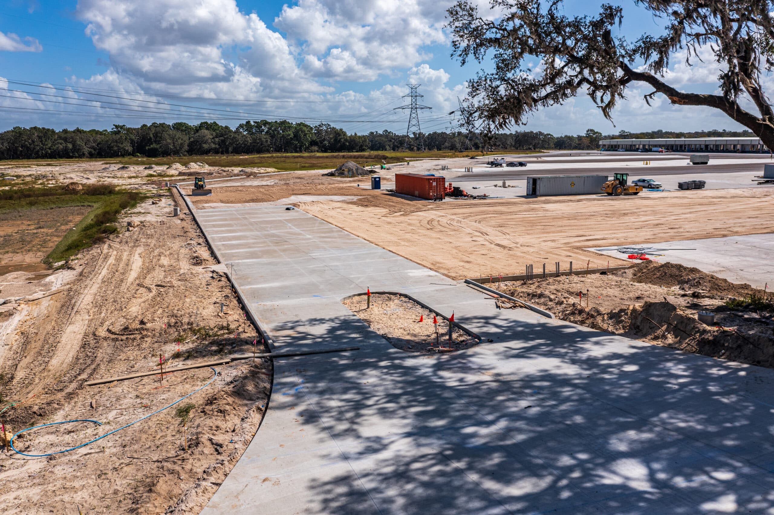
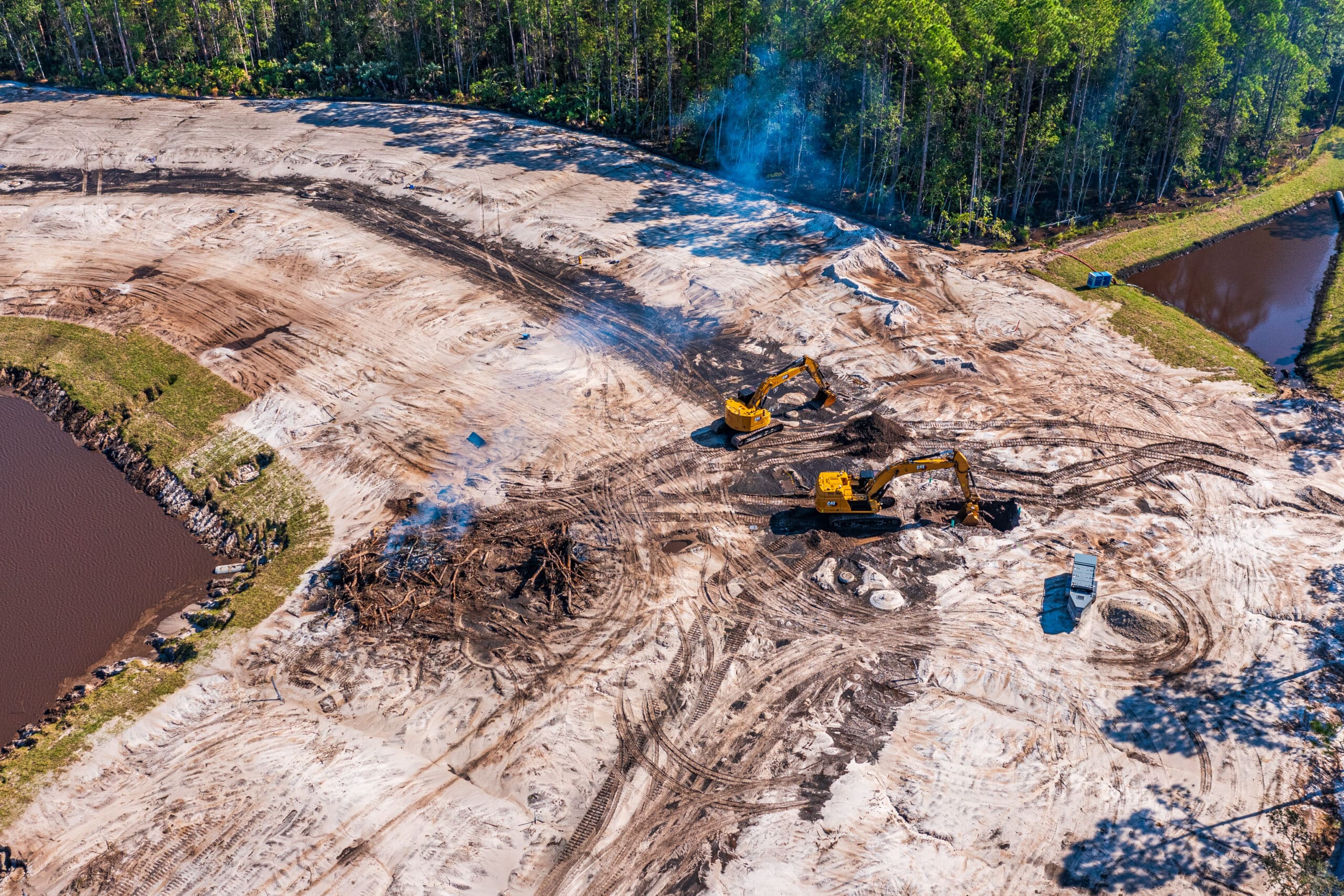
Construction Sites We Have Flown Recently
 Construction Progress Monitoring
10th Progress Monitoring Visit – Wildwood, FL
 Construction Progress Monitoring
Construction Progress Monitoring in Marion County, FL
- Construction Progress Monitoring
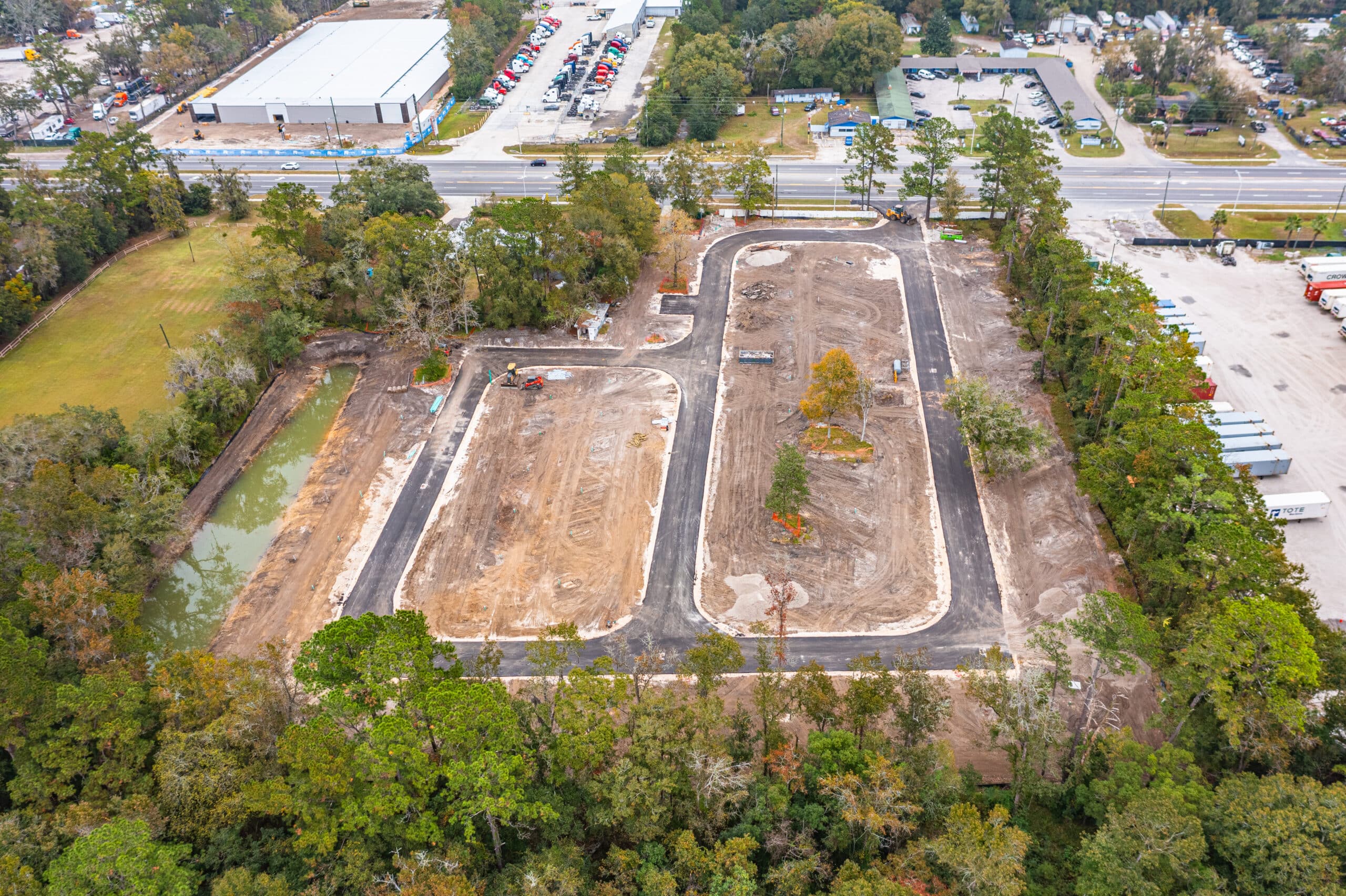
Drone Construction Progress Monitoring in Wildwood, FL
- Construction Progress Monitoring
Construction Drone Photography in St Johns County FL
- Construction Progress Monitoring
Pictures of RV Park in Jacksonville FL
- Construction Progress Monitoring
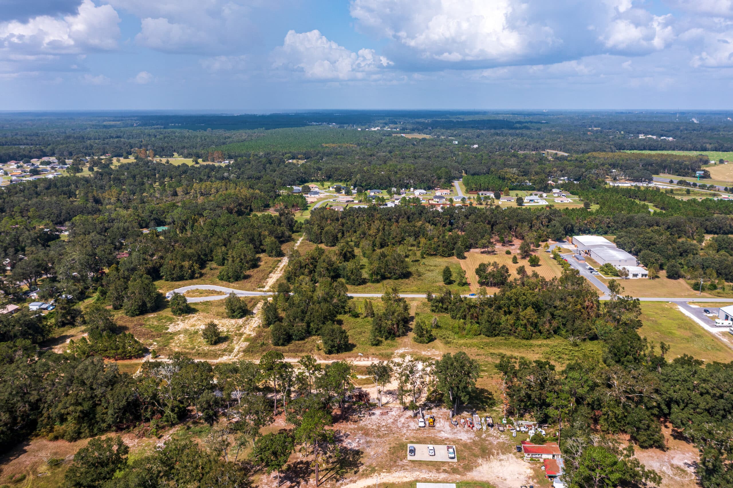
1st Lake City Construction Drone Visit
4 Key Uses of Drone Photography in Construction
")
High-Resolution Aerial Imaging for Progress Tracking
Drone photography provides clear, high-resolution images that help construction teams track progress over time. By capturing consistent aerial shots from the same angles, teams can visually document milestones, monitor site activity, and ensure deadlines are met. These images help project managers identify delays, inefficiencies, or material shortages before they become costly issues.
Aerial images also serve as a record of site conditions at different phases, which can be useful for resolving disputes, confirming work completion, and improving future project planning. Unlike traditional ground-level photos, drone images offer a full view of the site, making it easier to spot errors or discrepancies between plans and actual progress.
Site Overview & Project Planning
Before construction begins, aerial photography helps assess the site and plan logistics. Overhead images provide a complete view of the landscape, nearby structures, and potential obstacles, helping teams determine where to place materials, roads, and equipment. This top-down perspective allows for better site organization, reducing congestion and improving efficiency.
Drone photography is especially useful for large or complex projects where understanding the full scope of the site is difficult from the ground. With detailed aerial images, contractors can spot potential access issues, plan safe worker routes, and optimize site layout, leading to a smoother workflow and fewer unexpected disruptions.
")
")
Safety & Compliance Documentation
Regular drone photography helps construction companies visually document safety measures and compliance. Aerial images provide a clear view of equipment placement, worker activity, and potential hazards, making it easier for safety managers to identify risks before accidents happen. This proactive approach improves job site safety and helps ensure compliance with OSHA and other regulatory standards.
In the event of an accident or inspection, drone photos serve as evidence of proper safety protocols. Companies can use these images to show that required measures were in place or to review incidents for future safety improvements. By consistently capturing updated site images, construction firms can protect themselves from liability while creating a safer work environment.
Marketing & Stakeholder Communication
High-quality drone photography is a powerful tool for showcasing a construction project’s progress and final results. Aerial images and videos can be used for investor reports, client updates, and promotional materials, providing a visually compelling way to demonstrate the scale and quality of the work being done.
These images are also ideal for website galleries, social media, and marketing brochures, helping construction firms attract new clients and stand out in a competitive industry. By offering a unique perspective of the project, drone photography allows stakeholders to see the entire scope of development, making it easier to highlight achievements and secure future business.
")
Build Better with Consistent, High-Quality Media
Elevate Your Construction Sites Today!
Build Better with Consistent, High-Quality Media
Elevate Your Construction Sites Today!
Why Choose Us?
Experienced FAA Certified Pilots
Our drone pilots are FAA-certified and have years of experience capturing high-quality imagery for construction projects. We train using our unique construction framework that we've developed over years of providing drone services
Consistent Results
We deliver consistent results by using advanced drone technology, precise data collection methods, and standardized workflows, ensuring accuracy and reliability on every construction project
Clear Communication
Licensed & Insured
We prioritize safety and risk management by maintaining 2m+ insurance coverage when requested, ensuring that you can focus on your project's progress while knowing you're protected by professional and responsible drone services.
Portfolio
") +
+10th Progress Monitoring Visit – Wildwood, FL
Construction Progress Monitoring- +
Construction Progress Monitoring in Marion County, FL
Construction Progress Monitoring - +
Drone Construction Progress Monitoring in Wildwood, FL
Construction Progress Monitoring - +
Construction Drone Photography in St Johns County FL
Construction Progress Monitoring - +
Pictures of RV Park in Jacksonville FL
Construction Progress Monitoring - +
1st Lake City Construction Drone Visit
Construction Progress Monitoring
")
")
")
")
")
")
")
10th Progress Monitoring Visit – Wildwood, FL
Construction Progress Monitoring")
Construction Progress Monitoring in Marion County, FL
Construction Progress MonitoringDrone Construction Progress Monitoring in Wildwood, FL
Construction Progress MonitoringConstruction Drone Photography in St Johns County FL
Construction Progress MonitoringPictures of RV Park in Jacksonville FL
Construction Progress Monitoring1st Lake City Construction Drone Visit
Construction Progress Monitoring
")
")
")
")
")
")
Our Process for Construction Drone Services
At FL Construction Drone Services, we follow a structured, results-driven process to ensure our drone services meet the unique needs of project managers, contractors, developers, and architects.
From initial consultation to final data delivery, our goal is to provide precise, high-quality insights that help you build smarter, faster, and safer.
We have come to develop this process that allows us to provide drone solutions tailored for the construction industry
01
Step 1: Initial Consultation to Understand Project Needs
Every construction project is unique, which is why we start with a detailed consultation to assess your specific requirements. Whether you need progress tracking for a high-rise downtown, site surveys for a UF campus expansion, or safety inspections for an I-75 infrastructure project, we customize our approach to deliver the best results.
02
Step 2: Customized Flight Planning & Scheduling
Once we understand your needs, our FAA-certified drone pilots create a customized flight plan that optimizes coverage, efficiency, and safety. We schedule flights at times that minimize disruption to your operations, ensuring seamless integration with your existing workflow.
03
Step 3: Data Collection & Analysis
Using state-of-the-art drones equipped with high-resolution cameras, LiDAR, and thermal imaging, we capture detailed aerial imagery, 3D maps, and site data. Our team then processes and analyzes the data, identifying key insights such as site progress, potential hazards, or material shortages before they cause delays.
04
Step 4: Delivery of Actionable Insights & High-Resolution Imagery
We provide easy-to-interpret reports, high-resolution visuals, and actionable insights that help you make informed decisions quickly. Our deliverables include Aerial photos and videos for stakeholder presentations, 3D site maps for accurate planning and progress tracking, Thermal imaging reports for safety assessments, and Custom data exports compatible with your project management software.
Our Drone Pilots are available to fly Construction Sites in the following cities and areas:
Build Better with Consistent, High-Quality Media
Elevate Your Construction Sites Today!
Build Better with Consistent, High-Quality Media
Elevate Your Construction Sites Today!
© 2026 FL Construction Drone Services | All rights reserved